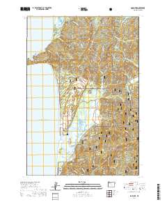
2020 Map of Sand Lake
USGS Topo · Published 2020About this map
Cape Lookout dominates this coastal landscape, extending westward into the Pacific Ocean and providing a natural anchor for the surrounding ecosystem. This 2020 topographic record highlights the complex hydrology of the region, where numerous small waterways like Big Medicine Cr and Hathaway Cr drain from the high ridges of the Siuslaw National Forest toward the shore. The interior of the coastline features significant estuarine environments, most notably Sand Lake and Whalen Island, which are critical habitats protected in part by the Oregon Islands National Wildlife Refuge. The settlement of Sandlake sits at a junction of inland roads, while the coastal community of Tierra Del Mar occupies the narrow strip of land between the dunes and the sea. This modern survey demonstrates the balance between managed forest lands and sensitive coastal wetlands along the southern edges of Netarts Bay.
Find a feature on this map
58 named features on this map. Tap any name to fly to it.
Don’t see what you’re looking for? This feature index may not catch every label — zoom into the map to look around manually.
Map Details
Editions of this 2020 Sand Lake Map
This is the sole edition of this map. No revisions or reprints were ever made.
Other maps of this area

1941 · Nestucca Bay
USGS Topo · 1:62,500

1942 · Nestucca Bay
USGS Topo · 1:62,500

1942 · Tillamook
USGS Topo · 1:62,500

1948 · Vancouver
USGS Topo · 1:250,000

1950 · Vancouver
USGS Topo · 1:250,000

1950 · Vancouver
USGS Topo · 1:250,000

1955 · Hebo
USGS Topo · 1:62,500

1955 · Tillamook
USGS Topo · 1:62,500

1958 · Vancouver
USGS Topo · 1:250,000

1964 · Vancouver
USGS Topo · 1:250,000