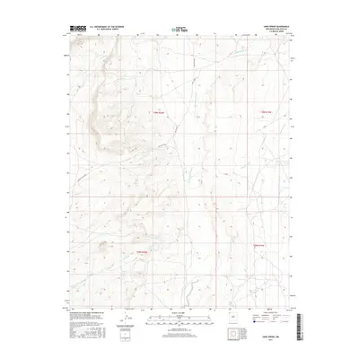
2017 Map of Sand Spring
USGS Topo · Published 2017About this map
Sand Spring and the nearby Sand Springs area form the heart of this high-desert landscape within the Shiprock Agency region. This 2017 survey by the U.S. Geological Survey documents a network of intermittent watercourses that shape the terrain, including the prominent Little Shiprock Wash and Shiprock Wash to the east, as well as Red Wash and Salt Wash. These geographic features dictate the sparse settlement patterns and the alignment of local infrastructure. Transportation through this part of San Juan County is defined by several designated tribal and service roads, notably Indian Rte 5020 and Ind Sr 5020, which traverse the arid stretches between the wash systems. The map provides a detailed look at the public land survey system, illustrating the township and range divisions that structure this section of the New Mexico landscape.
Find a feature on this map
14 named features on this map. Tap any name to fly to it.
Don’t see what you’re looking for? This feature index may not catch every label — zoom into the map to look around manually.
Map Details
Editions of this 2017 Sand Spring Map
This is the sole edition of this map. No revisions or reprints were ever made.
Other maps of this area

1889 · Chaco
USGS Topo · 1:250,000

1892 · Chaco
USGS Topo · 1:250,000

1892 · Canyon De Chelly
USGS Topo · 1:250,000

1934 · Ship Rock
USGS Topo · 1:62,500

1934 · Rattlesnake
USGS Topo · 1:62,500

1937 · Ship Rock
USGS Topo · 1:62,500

1937 · Rattlesnake
USGS Topo · 1:62,500

1953 · Redrock Valley NE
USGS Topo · 1:24,000

1953 · Redrock Valley SE
USGS Topo · 1:24,000

1953 · Pastora Peak SE
USGS Topo · 1:24,000