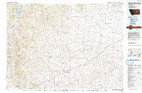
1993 Map of Sand Springs
USGS Topo · Published 1993About this map
The Charles M. Russell National Wildlife Refuge dominates the northwestern corner of this map, protecting the complex drainages that feed into Fort Peck Lake and the Missouri River. The landscape is defined by its dramatic relief, with countless landmarks like Cap Rock Butte and Haystack Butte rising above the plains. Settlement is concentrated along the sparse road network, most notably at Sand Springs and Brusett. The presence of the Moss Dome Oil Field in the southwest and several water management features, including Sand Springs Reservoir and Steel Mule Reservoir, illustrates the intersection of natural resource extraction and ranching requirements. In the south, the Musselshell River carves through the terrain near Wagga Wagga Creek, further illustrating the intricate hydrological network of Garfield Co.
Find a feature on this map
58 named features on this map. Tap any name to fly to it.
Don’t see what you’re looking for? This feature index may not catch every label — zoom into the map to look around manually.
Map Details
Editions of this 1993 Sand Springs Map
This is the sole edition of this map. No revisions or reprints were ever made.
Other maps of this area

1954 · Jordan
USGS Topo · 1:250,000

1954 · Forsyth
USGS Topo · 1:250,000

1954 · Roundup
USGS Topo · 1:250,000

1954 · Lewistown
USGS Topo · 1:250,000

1956 · Jordan
USGS Topo · 1:250,000

1957 · Forsyth
USGS Topo · 1:250,000

1958 · Jordan
USGS Topo · 1:250,000

1958 · Roundup
USGS Topo · 1:250,000

1958 · Forsyth
USGS Topo · 1:250,000

1958 · Maloney Hill
USGS Topo · 1:62,500