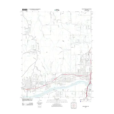
2012 Map of Sand Springs
USGS Topo · Published 2012About this map
The Arkansas River defines the southern industrial and residential corridor of this region, where the urban expansion of West Tulsa meets the established community of Sands Springs Lake. This landscape is characterized by a mix of high-elevation points like Holmes Peak and Reservoir Hill and the creek valleys of Turkey Cr and Euchee Cr. The presence of the Tullahassee Creek Indian Cem, alongside Woodland Cem and Hellard Cem, points to the long-standing cultural and genealogical history of this portion of Tulsa County.
Find a feature on this map
105 named features on this map. Tap any name to fly to it.
Don’t see what you’re looking for? This feature index may not catch every label — zoom into the map to look around manually.
Map Details
Editions of this 2012 Sand Springs Map
This is the sole edition of this map. No revisions or reprints were ever made.
Other maps of this area

1901 · Claremore
USGS Topo · 1:125,000

1912 · Hominy
USGS Topo · 1:125,000

1914 · Claremore
USGS Topo · 1:125,000

1915 · Hominy
USGS Topo · 1:125,000

1916 · Claremore
USGS Topo · 1:125,000

1952 · Jenks
USGS Topo · 1:24,000

1954 · Tulsa
USGS Topo · 1:250,000

1954 · Tulsa
USGS Topo · 1:24,000

1955 · Sperry
USGS Topo · 1:24,000

1955 · Enid
USGS Topo · 1:250,000