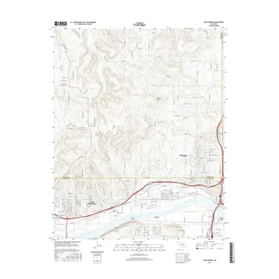
2016 Map of Sand Springs
USGS Topo · Published 2016About this map
Sand Springs and the western reaches of Tulsa are the focal points of this landscape, situated along a winding stretch of the Arkansas River. This modern survey illustrates the dense residential grid and industrial infrastructure bordering the river, contrasted with the more sparsely developed hills to the north. To the south, smaller riverside settlements like Price, Kengle, and Gray line the southern bank. The presence of the St Louis-San Francisco Ry underscores the corridor's long-standing role as a transportation hub. In the uplands north of the city, Holmes Peak rises above a network of creeks, including Turkey Cr and Shell Cr. Local history is anchored by the Woodland Cem and Hellard Cem, while Sand Springs Lake and Theisen Lake provide distinct water features amidst the suburban expansion.
Find a feature on this map
97 named features on this map. Tap any name to fly to it.
Don’t see what you’re looking for? This feature index may not catch every label — zoom into the map to look around manually.
Map Details
Editions of this 2016 Sand Springs Map
This is the sole edition of this map. No revisions or reprints were ever made.
Other maps of this area

1901 · Claremore
USGS Topo · 1:125,000

1912 · Hominy
USGS Topo · 1:125,000

1914 · Claremore
USGS Topo · 1:125,000

1915 · Hominy
USGS Topo · 1:125,000

1916 · Claremore
USGS Topo · 1:125,000

1952 · Jenks
USGS Topo · 1:24,000

1954 · Tulsa
USGS Topo · 1:250,000

1954 · Tulsa
USGS Topo · 1:24,000

1955 · Sperry
USGS Topo · 1:24,000

1955 · Enid
USGS Topo · 1:250,000