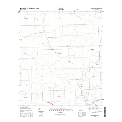
2015 Map of Sanderson North
USGS Topo · Published 2015About this map
The Osceola National Forest occupies a large portion of this Baker County landscape, where thick timberlands are bisected by numerous family-named roads and rural corridors. Near the southern boundary, the community of Sanderson sits alongside the rail corridor, anchored by the Sanderson Cem. The map reveals a settlement pattern defined by these namesake routes, including Herod Dopson Rd, Willie Griffis Rd, and Fred Harvey Rd, which trace the history of local landownership and transit. The drainage network is dominated by the winding course of Cedar Cr and its tributaries, such as Calkins Cr, which flow through the forested terrain. Farther north, the landscape becomes increasingly dominated by the protected forest lands, with small clearings and rural crossings like Jack Dugger Rd providing the only break in the woodland cover. This detailed survey captures the intersection of public forest management and the enduring local geography of north Florida.
Find a feature on this map
43 named features on this map. Tap any name to fly to it.
Don’t see what you’re looking for? This feature index may not catch every label — zoom into the map to look around manually.
Map Details
Editions of this 2015 Sanderson North Map
This is the sole edition of this map. No revisions or reprints were ever made.
Other maps of this area

1917 · Macclenny
USGS Topo · 1:62,500

1918 · Lawtey
USGS Topo · 1:62,500

1918 · Macclenny
USGS Topo · 1:62,500

1954 · Valdosta
USGS Topo · 1:250,000

1958 · Valdosta
USGS Topo · 1:250,000

1959 · Valdosta
USGS Topo · 1:250,000

1963 · Olustee
USGS Topo · 1:24,000

1963 · Sanderson South
USGS Topo · 1:24,000

1969 · Sanderson NW
USGS Topo · 1:24,000

1969 · Sanderson North
USGS Topo · 1:24,000