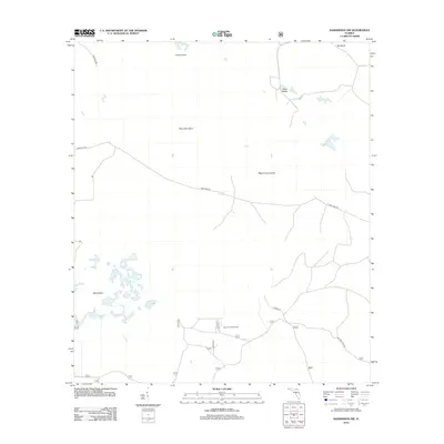
2012 Map of Sanderson NW
USGS Topo · Published 2012About this map
Reddish Millsite sits in the northern reaches of this Florida interior, a landscape defined by isolated islands of higher ground rising from the surrounding wetlands. This 2012 survey documents the rural character of northern Columbia County, where the terrain is punctuated by named features such as Clay Hole Island, Negro Camp Island, and Noah Island. The drainage and water patterns are most evident around Buck Island and its adjacent Buck Island Lake. The road network is primarily composed of unpaved tracks and forest routes, including Sand Hill Rd and Sand Mill Rd, which provide access to seasonal locations like the Big Camp Hunt Camp. The layout suggests a region largely managed for timber or recreation, with many numbered forest roads crisscrossing the low-lying terrain near Big Bend.
Find a feature on this map
24 named features on this map. Tap any name to fly to it.
Don’t see what you’re looking for? This feature index may not catch every label — zoom into the map to look around manually.
Map Details
Editions of this 2012 Sanderson NW Map
This is the sole edition of this map. No revisions or reprints were ever made.
Other maps of this area

1954 · Valdosta
USGS Topo · 1:250,000

1955 · Council
USGS Topo · 1:24,000

1956 · Eddy
USGS Topo · 1:24,000

1956 · Sargent
USGS Topo · 1:24,000

1958 · Valdosta
USGS Topo · 1:250,000

1959 · Valdosta
USGS Topo · 1:250,000

1961 · Deep Creek
USGS Topo · 1:24,000

1967 · Sargent
USGS Topo · 1:24,000
1967 · Eddy
USGS Topo · 1:24,000

1969 · Sanderson NW
USGS Topo · 1:24,000