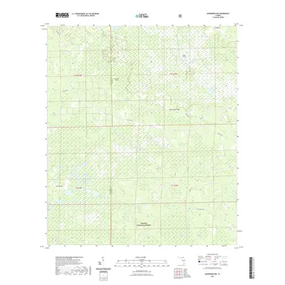
2021 Map of Sanderson NW
USGS Topo · Published 2021About this map
Osceola National Forest encompasses the vast majority of this landscape along the border of Columbia and Baker Counties, defined by a complex network of wetlands and wooded "islands." The interior terrain is dominated by significant swamp systems, including Rinhook Swamp to the north and the extensive Buckhead Swamp to the south. These are punctuated by curiously named upland features such as Negro Camp Island and Clay Hole Island, which historically provided slightly higher ground within the waterlogged basin. A primitive road network, including Sand Mill Rd and Old Sand Hill Rd, provides the only terrestrial access through this protected timber and wildlife area. Localized depressions form distinct bodies of water like Buck Island Lake and several "bays"—low-lying boggy areas—such as Impassable Bay and Little Bear Bay, illustrating the hydrologic character of the Florida panhandle's interior flatwoods.
Find a feature on this map
33 named features on this map. Tap any name to fly to it.
Don’t see what you’re looking for? This feature index may not catch every label — zoom into the map to look around manually.
Map Details
Editions of this 2021 Sanderson NW Map
This is the sole edition of this map. No revisions or reprints were ever made.
Other maps of this area

1954 · Valdosta
USGS Topo · 1:250,000

1955 · Council
USGS Topo · 1:24,000

1956 · Eddy
USGS Topo · 1:24,000

1956 · Sargent
USGS Topo · 1:24,000

1958 · Valdosta
USGS Topo · 1:250,000

1959 · Valdosta
USGS Topo · 1:250,000

1961 · Deep Creek
USGS Topo · 1:24,000

1967 · Sargent
USGS Topo · 1:24,000
1967 · Eddy
USGS Topo · 1:24,000

1969 · Sanderson NW
USGS Topo · 1:24,000