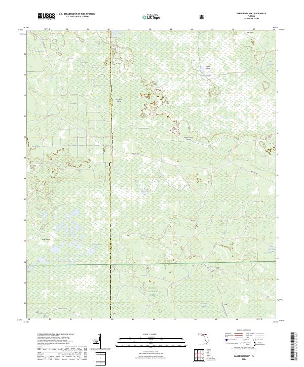
2024 Map of Sanderson NW
USGS Topo · Published 2024About this map
Osceola National Forest and the Big Gum Swamp Wilderness dominate this northern Florida landscape, where the boundary between Columbia and Baker counties cuts through a mosaic of wetlands and pine flatwoods. The terrain is defined by its water-logged lowlands, featuring prominent drainage features like Pinhook Swamp and the descriptively named Impassable Bay. These wet environments are interspersed with "islands"—slightly elevated ground often named for local history or natural features, such as Negro Camp Island, Noah Island, and Buck Island.
Find a feature on this map
34 named features on this map. Tap any name to fly to it.
Don’t see what you’re looking for? This feature index may not catch every label — zoom into the map to look around manually.
Map Details
Editions of this 2024 Sanderson NW Map
This is the sole edition of this map. No revisions or reprints were ever made.
Other maps of this area

1954 · Valdosta
USGS Topo · 1:250,000

1955 · Council
USGS Topo · 1:24,000

1956 · Eddy
USGS Topo · 1:24,000

1956 · Sargent
USGS Topo · 1:24,000

1958 · Valdosta
USGS Topo · 1:250,000

1959 · Valdosta
USGS Topo · 1:250,000

1961 · Deep Creek
USGS Topo · 1:24,000

1967 · Sargent
USGS Topo · 1:24,000
1967 · Eddy
USGS Topo · 1:24,000

1969 · Sanderson NW
USGS Topo · 1:24,000