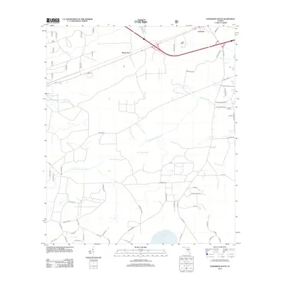
2012 Map of Sanderson South
USGS Topo · Published 2012About this map
The S Prong Saint Marys River defines the drainage of this Florida landscape, winding through the expansive South Prong Swamp toward the north. This region near the settlement of Sanderson is characterized by its wetlands and low-lying basins, including Granny Bay and Swift Creek Pond. To the west, Manns Spur marks a point along the transportation corridor that parallels the local topography.
Find a feature on this map
50 named features on this map. Tap any name to fly to it.
Don’t see what you’re looking for? This feature index may not catch every label — zoom into the map to look around manually.
Map Details
Editions of this 2012 Sanderson South Map
This is the sole edition of this map. No revisions or reprints were ever made.
Other maps of this area

1917 · Macclenny
USGS Topo · 1:62,500

1918 · Lawtey
USGS Topo · 1:62,500

1918 · Macclenny
USGS Topo · 1:62,500

1954 · Valdosta
USGS Topo · 1:250,000

1958 · Valdosta
USGS Topo · 1:250,000

1959 · Valdosta
USGS Topo · 1:250,000

1963 · Olustee
USGS Topo · 1:24,000

1963 · Sanderson South
USGS Topo · 1:24,000

1966 · Lake Butler
USGS Topo · 1:24,000
1966 · Lulu
USGS Topo · 1:24,000