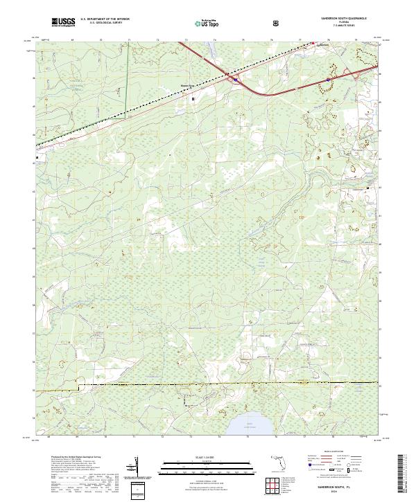
2024 Map of Sanderson South
USGS Topo · Published 2024About this map
Osceola National Forest defines the northern reaches of this Florida landscape, where the waters of the South Prong Saint Marys River wind through a dense network of wetlands. This 2024 survey captures the rural boundary between Baker and Union Counties, characterized by expansive lowlands such as Wampee Bay, Granny Bay, and the South Prong Swamp. The transition from forest to settlement is marked by Manns Spur and the southern edge of Sanderson, with local history etched into the landscape via family-named routes and the South Prong Cemetery.
Find a feature on this map
74 named features on this map. Tap any name to fly to it.
Don’t see what you’re looking for? This feature index may not catch every label — zoom into the map to look around manually.
Map Details
Editions of this 2024 Sanderson South Map
This is the sole edition of this map. No revisions or reprints were ever made.
Other maps of this area

1917 · Macclenny
USGS Topo · 1:62,500

1918 · Lawtey
USGS Topo · 1:62,500

1918 · Macclenny
USGS Topo · 1:62,500

1954 · Valdosta
USGS Topo · 1:250,000

1958 · Valdosta
USGS Topo · 1:250,000

1959 · Valdosta
USGS Topo · 1:250,000

1963 · Olustee
USGS Topo · 1:24,000

1963 · Sanderson South
USGS Topo · 1:24,000

1966 · Lake Butler
USGS Topo · 1:24,000
1966 · Lulu
USGS Topo · 1:24,000