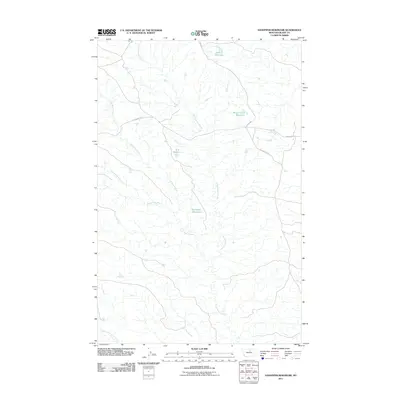
2011 Map of Sandpiper Reservoir
USGS Topo · Published 2011About this map
Bullwhacker Coulee carves a dominant path through this portion of Blaine County, defining a landscape of intermittent drainages and essential water storage in the early 21st century. The map reveals the critical role of ranching infrastructure in this arid environment, marked by isolated points of permanent water like Sandpiper Reservoir, Bud Reservoir, and the appropriately named Brush Shack Reservoir to the north. Movement through this territory is traced by historic routes and utilitarian ranch roads, including the Cow Island Trl, which skirts the coulees alongside Bullwhacker Rd. The drainage network is particularly intricate here, with the Coal Mine Coulee and Christenson Branch feeding into the larger system, illustrating the complex topography of the Montana plains. This survey provides a precise look at the drainage basins and naming conventions used by local landowners and federal agencies to manage these remote northern reaches.
Find a feature on this map
11 named features on this map. Tap any name to fly to it.
Don’t see what you’re looking for? This feature index may not catch every label — zoom into the map to look around manually.
Map Details
Editions of this 2011 Sandpiper Reservoir Map
This is the sole edition of this map. No revisions or reprints were ever made.
Other maps of this area

1953 · Havre
USGS Topo · 1:250,000

1954 · Bird Rapids
USGS Topo · 1:24,000

1954 · Leroy
USGS Topo · 1:24,000

1954 · Sturgeon Island
USGS Topo · 1:24,000

1954 · Lewistown
USGS Topo · 1:250,000

1956 · Maddux
USGS Topo · 1:62,500

1956 · Rattlesnake
USGS Topo · 1:62,500

1957 · Havre
USGS Topo · 1:250,000

1958 · Havre
USGS Topo · 1:250,000

1959 · Lewistown
USGS Topo · 1:250,000