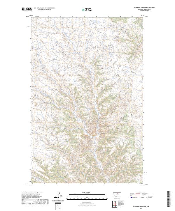
2024 Map of Sandpiper Reservoir
USGS Topo · Published 2024About this map
Upper Missouri River Breaks National Monument defines the southern half of this landscape, where the Missouri River drainage carves deep into the Montana plains. The topography is dominated by an intricate network of coulees, including the winding Bullwhacker Coulee and Coal Mine Coulee, reflecting a rugged erosion pattern characteristic of the breaks. Local water management is evident through a series of small uplands impoundments such as Sandpiper Reservoir, Blanch Reservoir, and Bud Reservoir, which serve this arid ranching country. Transportation is limited to primitive routes like the Cow Island Trl and Bullwhacker Rd, tracing high ridges between the drainages. These trails follow historical corridors used for moving livestock and supplies through the broken terrain above the Missouri River valley.
Find a feature on this map
18 named features on this map. Tap any name to fly to it.
Don’t see what you’re looking for? This feature index may not catch every label — zoom into the map to look around manually.
Map Details
Editions of this 2024 Sandpiper Reservoir Map
This is the sole edition of this map. No revisions or reprints were ever made.
Other maps of this area

1953 · Havre
USGS Topo · 1:250,000

1954 · Bird Rapids
USGS Topo · 1:24,000

1954 · Leroy
USGS Topo · 1:24,000

1954 · Sturgeon Island
USGS Topo · 1:24,000

1954 · Lewistown
USGS Topo · 1:250,000

1956 · Maddux
USGS Topo · 1:62,500

1956 · Rattlesnake
USGS Topo · 1:62,500

1957 · Havre
USGS Topo · 1:250,000

1958 · Havre
USGS Topo · 1:250,000

1959 · Lewistown
USGS Topo · 1:250,000