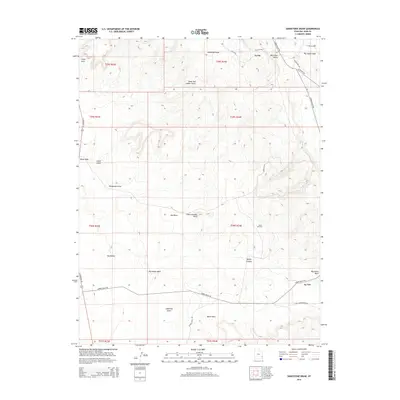
2014 Map of Sandstone Draw
USGS Topo · Published 2014About this map
Big Indian Valley and the surrounding high desert of San Juan County are defined by a complex network of ephemeral washes and distinct geological markers in this 2014 survey. The landscape is characterized by prominent natural landmarks such as Casa Colorado Rock, White Rock, and the isolated Lopez Arch near the northern boundary. Settlement is concentrated around La Sal, while the region's industrial footprint is evidenced by the Lisbon Oil Field and the Far W Oil Wls near the northern margin.
Find a feature on this map
31 named features on this map. Tap any name to fly to it.
Don’t see what you’re looking for? This feature index may not catch every label — zoom into the map to look around manually.
Map Details
Editions of this 2014 Sandstone Draw Map
This is the sole edition of this map. No revisions or reprints were ever made.
Other maps of this area

1885 · La Sal
USGS Topo · 1:250,000

1954 · Mt Peale 3 NW
USGS Topo · 1:24,000

1954 · Mt Peale 4 NW
USGS Topo · 1:24,000

1954 · Mt Peale 3 SW
USGS Topo · 1:24,000

1954 · Mt Peale 3 NE
USGS Topo · 1:24,000

1954 · Mt Peale 3 SE
USGS Topo · 1:24,000

1954 · Mt Peale 1 SW
USGS Topo · 1:24,000

1954 · Mt Peale 2 SW
USGS Topo · 1:24,000

1954 · Mt Peale 2 SE
USGS Topo · 1:24,000

1954 · Mt Peale 4 SW
USGS Topo · 1:24,000