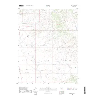
2023 Map of Sandstone Draw
USGS Topo · Published 2023About this map
La Sal serves as the primary point of settlement at the northern edge of this high-altitude San Juan County landscape, where the terrain breaks into a complex network of canyons and gulches. The geography is defined by significant drainage systems, notably Big Indian Wash which carves through the Big Indian Valley, and the expansive Dry Valley to the southwest. This 2023 survey illustrates a landscape deeply shaped by resource extraction and transportation, evidenced by a dense network of industrial access routes including Homestake Rd, Union Oil Rd, and Steens Rd. These roads snake through the dramatic relief of Sandstone Draw and Spiller Canyon, reflecting the area's modern utility alongside natural landmarks like Lopez Arch. The map details the intricate topography between Hook and Ladder Gulch and Lightning Draw, showing how human infrastructure integrates with the seasonal watercourses of Hatch Wash and the surrounding high desert terrain.
Find a feature on this map
25 named features on this map. Tap any name to fly to it.
Don’t see what you’re looking for? This feature index may not catch every label — zoom into the map to look around manually.
Map Details
Editions of this 2023 Sandstone Draw Map
This is the sole edition of this map. No revisions or reprints were ever made.
Other maps of this area

1885 · La Sal
USGS Topo · 1:250,000

1954 · Mt Peale 3 NW
USGS Topo · 1:24,000

1954 · Mt Peale 4 NW
USGS Topo · 1:24,000

1954 · Mt Peale 3 SW
USGS Topo · 1:24,000

1954 · Mt Peale 3 NE
USGS Topo · 1:24,000

1954 · Mt Peale 3 SE
USGS Topo · 1:24,000

1954 · Mt Peale 1 SW
USGS Topo · 1:24,000

1954 · Mt Peale 2 SW
USGS Topo · 1:24,000

1954 · Mt Peale 2 SE
USGS Topo · 1:24,000

1954 · Mt Peale 4 SW
USGS Topo · 1:24,000