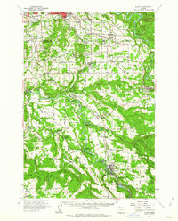
1961 Map of Sandy
USGS Topo · Published 1962About this map
The Clackamas River and Sandy River define the hydraulic and economic landscape of this Clackamas County region in the early 1960s. The map illustrates a transition from the developing outskirts of Gresham to the industrial and agricultural corridors of the south. Significant infrastructure is concentrated near the river bends, notably the Cazadero Powerhouse and Faraday Powerhouse near Estacada, which utilized the river's flow for power generation.
Find a feature on this map
76 named features on this map. Tap any name to fly to it.
Don’t see what you’re looking for? This feature index may not catch every label — zoom into the map to look around manually.
Map Details
Editions of this 1961 Sandy Map
This is the sole edition of this map. No revisions or reprints were ever made.
Other maps of this area

1897 · Portland
USGS Topo · 1:62,500

1905 · Portland
USGS Topo · 1:62,500

1911 · Boring
USGS Topo · 1:48,000

1914 · Boring
USGS Topo · 1:62,500

1914 · Oregon City
USGS Topo · 1:62,500

1916 · Estacada
USGS Topo · 1:125,000

1918 · Troutdale
USGS Topo · 1:62,500

1934 · Troutdale
USGS Topo · 1:48,000

1939 · Molalla
USGS Topo · 1:62,500

1939 · Oregon City
USGS Topo · 1:62,500