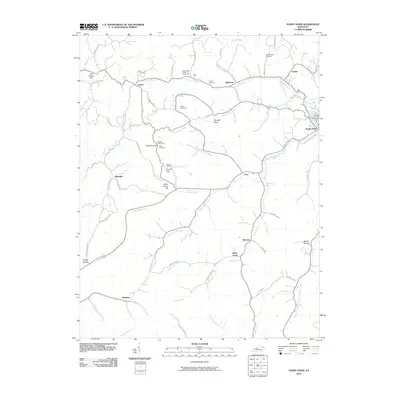
2010 Map of Sandy Hook
USGS Topo · Published 2010About this map
Sandy Hook and its surrounding rural landscapes are defined by the winding course of the Little Sandy River and a dense network of upland ridges. This 2010 survey illustrates a region where family lineage and local geography are deeply intertwined, evidenced by numerous small burial grounds such as Whitt Cemetery, Click Cemetery, and the Polk Howard Cemetery dotting the hillsides. Settlement patterns follow the creek beds and ridges, with named hamlets like Lytten and Bigstone connected by a web of narrow roads including Fraley Ridge Rd and The Ridge Ruin Rd. The topography is marked by distinct summits like Doctors Knob, which serves as a landmark for the surrounding Doctors Branch and Turkey Branch. In the southern reaches, the North Fork Licking River emerges near the community of Redwine, marking a subtle hydrological divide in the heart of Elliott County.
Find a feature on this map
75 named features on this map. Tap any name to fly to it.
Don’t see what you’re looking for? This feature index may not catch every label — zoom into the map to look around manually.
Map Details
Editions of this 2010 Sandy Hook Map
This is the sole edition of this map. No revisions or reprints were ever made.
Other maps of this area

1889 · Salyersville
USGS Topo · 1:125,000

1891 · Salyersville
USGS Topo · 1:125,000

1899 · Salyersville
USGS Topo · 1:125,000

1929 · Morehead
USGS Topo · 1:48,000

1935 · Morehead
USGS Topo · 1:62,500

1950 · Bruin
USGS Topo · 1:24,000

1950 · Isonville
USGS Topo · 1:24,000

1950 · Ault
USGS Topo · 1:24,000

1950 · Sandy Hook
USGS Topo · 1:24,000

1950 · Lenox
USGS Topo · 1:24,000