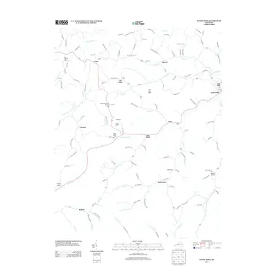
2013 Map of Sandy Hook
USGS Topo · Published 2013About this map
The Little Sandy River and its numerous contributing forks and branches define the geography of this Elliott County landscape. The settlement of Sandy Hook occupies the eastern edge of the map, while smaller communities like Lytten, Bigstone, and Redwine are situated along the winding valley roads. The region's topography is marked by significant high points including Doctors Knob, which is topped by the Doctors Knob Tower, and Elisha Fannin Hill.
Find a feature on this map
120 named features on this map. Tap any name to fly to it.
Don’t see what you’re looking for? This feature index may not catch every label — zoom into the map to look around manually.
Map Details
Editions of this 2013 Sandy Hook Map
This is the sole edition of this map. No revisions or reprints were ever made.
Other maps of this area

1889 · Salyersville
USGS Topo · 1:125,000

1891 · Salyersville
USGS Topo · 1:125,000

1899 · Salyersville
USGS Topo · 1:125,000

1929 · Morehead
USGS Topo · 1:48,000

1935 · Morehead
USGS Topo · 1:62,500

1950 · Bruin
USGS Topo · 1:24,000

1950 · Isonville
USGS Topo · 1:24,000

1950 · Ault
USGS Topo · 1:24,000

1950 · Sandy Hook
USGS Topo · 1:24,000

1950 · Lenox
USGS Topo · 1:24,000