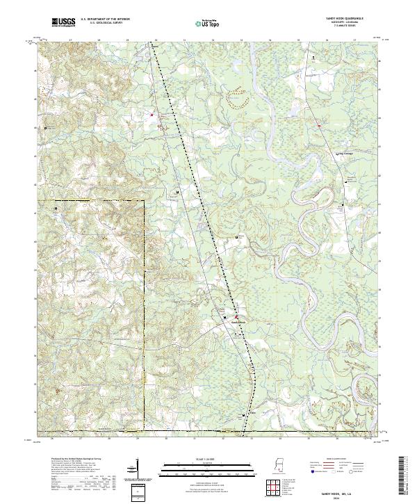
2024 Map of Sandy Hook
USGS Topo · Published 2024About this map
The Pearl River meanders across the border of Mississippi and Louisiana, creating a complex system of oxbows and backwaters in the southeast corner of Marion County. This recent survey documents the riparian landscape near the state line, where wetlands like Black Lake and Yellow Lake parallel the river's main channel. The settlement of Sandy Hook serves as a local hub, situated near the junction of several rural routes including Old Hwy 35 S and Warren Cemetery Rd.
Find a feature on this map
87 named features on this map. Tap any name to fly to it.
Don’t see what you’re looking for? This feature index may not catch every label — zoom into the map to look around manually.
Map Details
Editions of this 2024 Sandy Hook Map
This is the sole edition of this map. No revisions or reprints were ever made.
Other maps of this area

1949 · Angie
USGS Topo · 1:31,680

1950 · Crains Creek
USGS Topo · 1:31,680

1953 · Hattiesburg
USGS Topo · 1:250,000

1953 · Mobile
USGS Topo · 1:250,000

1957 · Mobile
USGS Topo · 1:250,000

1958 · Hattiesburg
USGS Topo · 1:250,000

1959 · Bogalusa
USGS Topo · 1:62,500

1959 · Poplarville
USGS Topo · 1:62,500

1960 · Mobile
USGS Topo · 1:250,000

1963 · Mobile
USGS Topo · 1:250,000