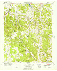
1951 Map of Sandy Hook
USGS Topo · Published 1956About this map
The phosphate mining industry of the mid-20th century is evident across this landscape, where numerous Strip mines dot the ridges around Sandy Hook and Enterprise. This area of southern Middle Tennessee, where the boundaries of Maury, Lawrence, and Giles counties meet, was a significant corridor for both commerce and travel. The L and N RR and the Jackson Highway facilitate transit through the hilly terrain, while older routes like Military Road cut through the hollows.
Find a feature on this map
75 named features on this map. Tap any name to fly to it.
Don’t see what you’re looking for? This feature index may not catch every label — zoom into the map to look around manually.
Map Details
Editions of this 1951 Sandy Hook Map
2 editions found
Other maps of this area

1901 · Colombia
USGS Topo · 1:125,000

1936 · Sandy Hook
USGS Topo · 1:24,000

1936 · Mt Joy
USGS Topo · 1:24,000

1936 · Milky Way
USGS Topo · 1:24,000

1936 · Campbellsville
USGS Topo · 1:24,000

1936 · Ethridge
USGS Topo · 1:24,000

1936 · Crestview
USGS Topo · 1:24,000

1936 · Mount Pleasant
USGS Topo · 1:24,000

1936 · Columbia
USGS Topo · 1:24,000

1936 · Lynnville
USGS Topo · 1:24,000