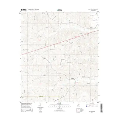
2015 Map of Sandy Hook NW
USGS Topo · Published 2015About this map
New Hope and the surrounding piney woods of Marion County are documented in this 2015 study, which highlights a landscape of dispersed rural settlements and small family landmarks. Near the Marion Co/Walthall Co border, the terrain is defined by a network of creeks including Silver Creek and Tenmile Creek. The map shows a high concentration of local burial sites, such as Lott Memorial Cemetery and Turnage Chapel Cemetery, which are essential for genealogical research in this part of Mississippi. Transportation routes vary from state-maintained corridors like Old MS 24 to narrow forest tracks like Shiloh Firetower Road. Settlement clusters at Sumbax and Hamage illustrate the persistent rural character of the area, while the Browns Landing Airport provides a modern aviation landmark amidst the traditional farm and timber lands.
Find a feature on this map
86 named features on this map. Tap any name to fly to it.
Don’t see what you’re looking for? This feature index may not catch every label — zoom into the map to look around manually.
Map Details
Editions of this 2015 Sandy Hook NW Map
This is the sole edition of this map. No revisions or reprints were ever made.
Other maps of this area

1953 · Hattiesburg
USGS Topo · 1:250,000

1953 · Natchez
USGS Topo · 1:250,000

1956 · Natchez
USGS Topo · 1:250,000

1958 · Hattiesburg
USGS Topo · 1:250,000

1959 · Natchez
USGS Topo · 1:250,000

1970 · Columbia South
USGS Topo · 1:24,000

1970 · Sandy Hook NW
USGS Topo · 1:24,000
1970 · Tylertown SE
USGS Topo · 1:24,000

1970 · Kokomo
USGS Topo · 1:24,000

1970 · Darbun
USGS Topo · 1:24,000