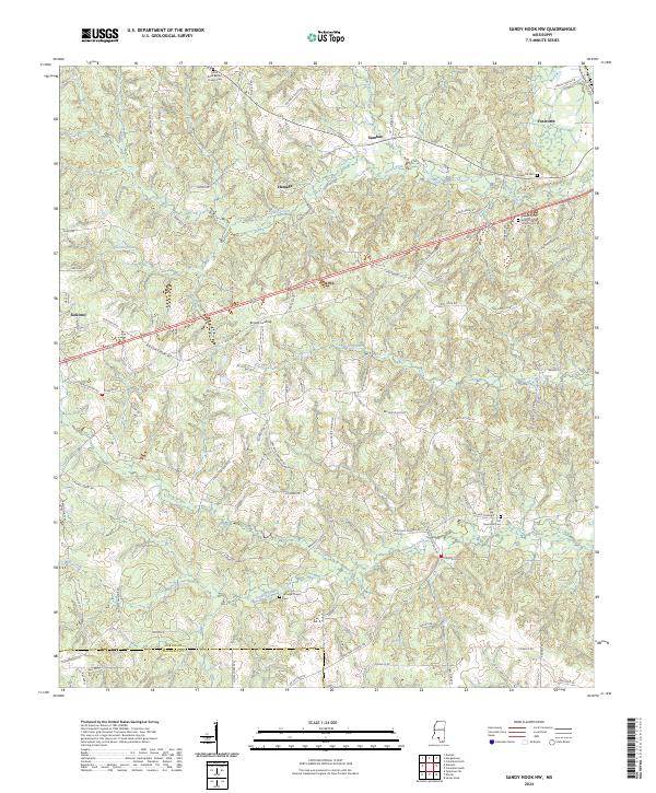
2024 Map of Sandy Hook NW
USGS Topo · Published 2024About this map
Kokomo and Foxworth anchor this 2024 landscape in Marion County, where the terrain is shaped by the winding paths of Silver Creek and Tenmile Creek. The map documents a rural network of small communities and landing sites, such as Browns Landing on Mays Creek and the settlement at Hamage. This contemporary survey provides vital data for genealogists tracing family ties to several denominational landmarks and burial grounds, including the Little Rock Baptist Church Cem, the Pleasant Hill Apostolic Church Cem, and the Turnage Chapel Cem. The road network, featuring Old Hwy 24 and Shiloh Firetower Rd, reflects the area's continued reliance on local connectors between established farms and the crossings of Richland Creek and Indian Creek.
Find a feature on this map
90 named features on this map. Tap any name to fly to it.
Don’t see what you’re looking for? This feature index may not catch every label — zoom into the map to look around manually.
Map Details
Editions of this 2024 Sandy Hook NW Map
This is the sole edition of this map. No revisions or reprints were ever made.
Other maps of this area

1953 · Hattiesburg
USGS Topo · 1:250,000

1953 · Natchez
USGS Topo · 1:250,000

1956 · Natchez
USGS Topo · 1:250,000

1958 · Hattiesburg
USGS Topo · 1:250,000

1959 · Natchez
USGS Topo · 1:250,000

1970 · Columbia South
USGS Topo · 1:24,000

1970 · Sandy Hook NW
USGS Topo · 1:24,000
1970 · Tylertown SE
USGS Topo · 1:24,000

1970 · Kokomo
USGS Topo · 1:24,000

1970 · Darbun
USGS Topo · 1:24,000