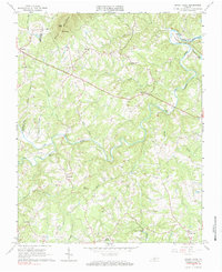
1965 Map of Sandy Level
USGS Topo · Published 1984About this map
Pigg River meanders through the heart of this Virginia landscape, marking the transition from the upland ridges of Smith Mountain and Greer Knob to the fertile bottomlands. In the mid-1960s, the rural character of the region remained defined by small crossroad communities like Museville, Ajax, and Penhook. The arrival of Leesville Lake in the northeast corner of the sheet, near The Fryingspan, indicates the influence of modern hydroelectric development on the historic drainage patterns of Fryingpan Cr. Scattered throughout the hills are indicators of long-standing local heritage, including Sandy Level Ch and the Carter Cem. The presence of Old Railroad Creek and several unnamed old railroad grades suggests a history of timber or mineral transport that once connected these remote settlements to wider markets.
Find a feature on this map
40 named features on this map. Tap any name to fly to it.
Don’t see what you’re looking for? This feature index may not catch every label — zoom into the map to look around manually.
Map Details
Editions of this 1965 Sandy Level Map
Other maps of this area

1890 · Roanoke
USGS Topo · 1:125,000

1891 · Roanoke
USGS Topo · 1:125,000

1892 · Lynchburg
USGS Topo · 1:125,000

1921 · Chatham
USGS Topo · 1:48,000

1922 · Callands
USGS Topo · 1:48,000

1923 · Chatham
USGS Topo · 1:62,500

1924 · Callands
USGS Topo · 1:62,500

1944 · Callands
USGS Topo · 1:62,500

1947 · Roanoke
USGS Topo · 1:250,000

1951 · Moneta
USGS Topo · 1:62,500