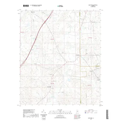
2020 Map of Sandy Ridge
USGS Topo · Published 2020About this map
Sandy Ridge sits at the intersection of rural life and historic transport corridors where Lowndes, Montgomery, and Crenshaw counties meet. This landscape is defined by its numerous private lakes and ponds, including W D Farrior Junior Lake, Gaston Lake, and W E Pritchett Lake Number Two, reflecting a history of local water management for agriculture and recreation. Small settlements like Letohatchee and Davenport anchor the northern and eastern portions of the map, while the terrain rises toward Pierces Hill in the center.
Find a feature on this map
55 named features on this map. Tap any name to fly to it.
Don’t see what you’re looking for? This feature index may not catch every label — zoom into the map to look around manually.
Map Details
Editions of this 2020 Sandy Ridge Map
This is the sole edition of this map. No revisions or reprints were ever made.
Other maps of this area

1953 · Montgomery
USGS Topo · 1:250,000

1953 · Andalusia
USGS Topo · 1:250,000

1956 · Montgomery
USGS Topo · 1:250,000

1957 · Montgomery
USGS Topo · 1:250,000

1957 · Andalusia
USGS Topo · 1:250,000

1957 · Letohatchee
USGS Topo · 1:62,500

1971 · Fort Deposit
USGS Topo · 1:24,000

1971 · Danielsville
USGS Topo · 1:24,000
1971 · Lapine
USGS Topo · 1:24,000
1981 · Snowdoun
USGS Topo · 1:24,000