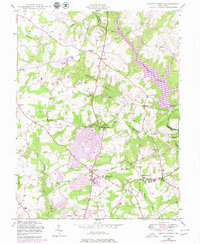
1945 Map of Sandy Spring
USGS Topo · Published 1979About this map
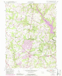
Olney and Brookeville serve as focal points for this mid-century Montgomery County landscape, which was undergoing significant residential expansion as documented by later purple revisions. The survey captures the suburbanizing countryside, where local landmarks like the Montgomery County General Hospital and Sherwood High Sch in Ashton define the community infrastructure. To the north, the Patuxent River and the large Triadelphia Reservoir dominate the terrain, bounded by the Patuxent River State Park. Smaller hamlets such as Unity and Sunshine remain relatively isolated amidst the network of waterways like the Hawlings River and Reddy Branch. This document provides a look at the area before the full density of modern development, preserving the locations of smaller rural institutions like Slade Sch and the original footprint of Sandy Spring.
Find a feature on this map
39 named features on this map. Tap any name to fly to it.
Don’t see what you’re looking for? This feature index may not catch every label — zoom into the map to look around manually.
Map Details
Editions of this 1945 Sandy Spring Map
5 editions found
Other maps of this area

1892 · Laurel
USGS Topo · 1:62,500

1892 · Ellicott
USGS Topo · 1:62,500

1893 · Frederick
USGS Topo · 1:125,000

1894 · Ellicott
USGS Topo · 1:62,500

1894 · Laurel
USGS Topo · 1:62,500

1894 · Frederick
USGS Topo · 1:125,000

1897 · Laurel
USGS Topo · 1:62,500

1906 · Ellicott
USGS Topo · 1:62,500

1907 · Laurel
USGS Topo · 1:62,500

1908 · Patapsco
USGS Topo · 1:125,000