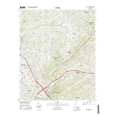
2017 Map of Sandy Springs
USGS Topo · Published 2017About this map
The Chattahoochee River carves a deep boundary between Cobb and Fulton Counties, anchoring a landscape where suburban expansion meets protected riverside terrain. In the late 2010s, this area shows the dense residential growth of Sandy Springs and Marietta, yet it preserves significant family history through numerous small burial grounds like Antioch Cem and Brown Cem. The river's character is defined by several notable shoals, including Chochran Shoals and Devils Race Course Shoals, which contrast with the modern infrastructure of the Johnson Ferry Bridge. Higher elevations such as Blackjack Mtn overlook a complex network of reservoirs and local lakes like Bishop Lake and Thompson Lake, illustrating how the region's topography has been adapted for both utility and recreation within the Chattahoochee River National Recreation Area.
Find a feature on this map
55 named features on this map. Tap any name to fly to it.
Don’t see what you’re looking for? This feature index may not catch every label — zoom into the map to look around manually.
Map Details
Editions of this 2017 Sandy Springs Map
This is the sole edition of this map. No revisions or reprints were ever made.
Other maps of this area

1888 · Atlanta
USGS Topo · 1:125,000

1890 · Suwanee
USGS Topo · 1:125,000

1890 · Cartersville
USGS Topo · 1:125,000

1890 · Atlanta
USGS Topo · 1:125,000

1891 · Marietta
USGS Topo · 1:125,000

1891 · Cartersville
USGS Topo · 1:125,000

1892 · Atlanta
USGS Topo · 1:125,000

1894 · Suwanee
USGS Topo · 1:125,000

1895 · Atlanta
USGS Topo · 1:125,000

1895 · Marietta
USGS Topo · 1:125,000