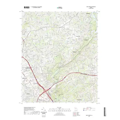
2020 Map of Sandy Springs
USGS Topo · Published 2020About this map
The Chattahoochee River carves a deep boundary between Cobb and Fulton Counties, anchoring a landscape where modern suburban expansion meets preserved riverfront recreation. In the northern reaches, Mount Bethel and Chattahoochee Plantation sit near significant water bodies like Thompson Lake and Lake Jackson. The map details an extensive network of green space, including the Chattahoochee River National Recreation Area and the Cochran Shoals Trail System, which trace the river's path past Chochran Shoals and Devils Race Course Shoals.
Find a feature on this map
52 named features on this map. Tap any name to fly to it.
Don’t see what you’re looking for? This feature index may not catch every label — zoom into the map to look around manually.
Map Details
Editions of this 2020 Sandy Springs Map
This is the sole edition of this map. No revisions or reprints were ever made.
Other maps of this area

1888 · Atlanta
USGS Topo · 1:125,000

1890 · Suwanee
USGS Topo · 1:125,000

1890 · Cartersville
USGS Topo · 1:125,000

1890 · Atlanta
USGS Topo · 1:125,000

1891 · Marietta
USGS Topo · 1:125,000

1891 · Cartersville
USGS Topo · 1:125,000

1892 · Atlanta
USGS Topo · 1:125,000

1894 · Suwanee
USGS Topo · 1:125,000

1895 · Atlanta
USGS Topo · 1:125,000

1895 · Marietta
USGS Topo · 1:125,000