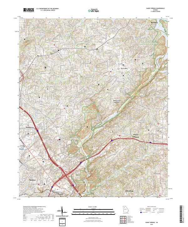
2024 Map of Sandy Springs
USGS Topo · Published 2024About this map
The Chattahoochee River National Recreation Area serves as the central corridor of this modern suburban landscape, marking the winding boundary between Cobb and Fulton counties. The river is characterized by numerous natural features including Cochran Shoals, Thornton Shoals, and the evocatively named Devils Race Course Shoals near Long Island. While the area is dominated by the growth of Sandy Springs and Marietta, dozens of smaller historical sites remain documented, such as the Marietta Campground Cem and New Providence Baptist Church.
Find a feature on this map
67 named features on this map. Tap any name to fly to it.
Don’t see what you’re looking for? This feature index may not catch every label — zoom into the map to look around manually.
Map Details
Editions of this 2024 Sandy Springs Map
This is the sole edition of this map. No revisions or reprints were ever made.
Other maps of this area

1888 · Atlanta
USGS Topo · 1:125,000

1890 · Suwanee
USGS Topo · 1:125,000

1890 · Cartersville
USGS Topo · 1:125,000

1890 · Atlanta
USGS Topo · 1:125,000

1891 · Marietta
USGS Topo · 1:125,000

1891 · Cartersville
USGS Topo · 1:125,000

1892 · Atlanta
USGS Topo · 1:125,000

1894 · Suwanee
USGS Topo · 1:125,000

1895 · Atlanta
USGS Topo · 1:125,000

1895 · Marietta
USGS Topo · 1:125,000