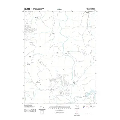
2011 Map of Sang Run
USGS Topo · Published 2011About this map
Sang Run sits at the heart of this landscape where the Youghiogheny River carves through a corridor of significant peaks. The settlement is anchored by the Sang Run Post Office and the Sang Run Cemetery, representing a stable community point in Garrett County's highland terrain. To the west, Cranesville marks the edge of the plateau near Nettle Ridge, while the southern reaches show the early industrial and recreational influence of water management at Deep Creek.
Find a feature on this map
142 named features on this map. Tap any name to fly to it.
Don’t see what you’re looking for? This feature index may not catch every label — zoom into the map to look around manually.
Map Details
Editions of this 2011 Sang Run Map
This is the sole edition of this map. No revisions or reprints were ever made.
Other maps of this area

1886 · St. George
USGS Topo · 1:125,000

1891 · St. George
USGS Topo · 1:125,000

1895 · Piedmont
USGS Topo · 1:125,000

1899 · Oakland
USGS Topo · 1:62,500

1900 · Accident
USGS Topo · 1:62,500

1900 · Oakland
USGS Topo · 1:62,500

1904 · Bruceton
USGS Topo · 1:62,500

1907 · Kingwood
USGS Topo · 1:62,500

1925 · Kingwood
USGS Topo · 1:62,500

1926 · Bruceton
USGS Topo · 1:62,500