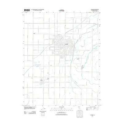
2012 Map of Sanger
USGS Topo · Published 2012About this map
The Kings River valley and its intricate network of irrigation channels define the landscape of this Fresno County region in the early 21st century. The city of Sanger serves as the primary hub, showing a dense street grid alongside the Sanger Winery and industrial footprints near the Centerville Kingsburg Canal. To the southwest, the smaller settlement of DelRey is surrounded by the agricultural infrastructure of Kudo Farms and the smaller locality of Clotho. The map reveals the vital role of water management in the Central Valley, tracing the Fowler Switch Canal and Highland Canal as they snake through the grid-like pattern of orchards and fields. Local history is anchored by several established burial grounds, including Sanger Cem, Bethel Cem, and Prairie Cem, which mark the community's centers of rest amid the productive agricultural plains.
Find a feature on this map
32 named features on this map. Tap any name to fly to it.
Don’t see what you’re looking for? This feature index may not catch every label — zoom into the map to look around manually.
Map Details
Editions of this 2012 Sanger Map
This is the sole edition of this map. No revisions or reprints were ever made.
Other maps of this area

1920 · Orangedale School
USGS Topo · 1:24,000

1922 · Round Mountain
USGS Topo · 1:31,680

1922 · Trimmer
USGS Topo · 1:96,000

1923 · Malaga
USGS Topo · 1:31,680

1923 · Orangedale School
USGS Topo · 1:31,680

1923 · Clovis
USGS Topo · 1:31,680

1923 · Wahtoke
USGS Topo · 1:31,680

1923 · Sanger
USGS Topo · 1:31,680

1924 · Reedley
USGS Topo · 1:31,680

1924 · Selma
USGS Topo · 1:31,680