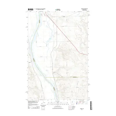
2014 Map of Sanger
USGS Topo · Published 2014About this map
The Missouri River serves as the primary geographic corridor through this section of central North Dakota, defining the borders between Oliver, McLean, and Burleigh Counties. The landscape is characterized by its complex river bottomlands and oxbow formations, most notably Painted Woods Lake and the smaller Beaver Lake. The settlement of Sanger is situated on the western bank in Oliver County, while the eastern side of the river features a network of secondary roads and local routes like ND-1804 and ND-83 that navigate the bluffs and coulees.
Find a feature on this map
39 named features on this map. Tap any name to fly to it.
Don’t see what you’re looking for? This feature index may not catch every label — zoom into the map to look around manually.
Map Details
Editions of this 2014 Sanger Map
This is the sole edition of this map. No revisions or reprints were ever made.
Other maps of this area

1949 · Turtle Creek
USGS Topo · 1:62,500

1949 · Washburn
USGS Topo · 1:62,500

1950 · Wilton
USGS Topo · 1:62,500

1954 · McClusky
USGS Topo · 1:250,000

1958 · McClusky
USGS Topo · 1:250,000

1961 · Turtle Creek SW
USGS Topo · 1:24,000

1961 · Washburn
USGS Topo · 1:24,000

1961 · Turtle Creek SE
USGS Topo · 1:24,000

1966 · Price
USGS Topo · 1:24,000

1966 · Wilton SE
USGS Topo · 1:24,000