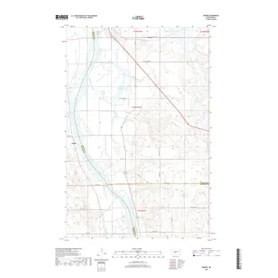
2018 Map of Sanger
USGS Topo · Published 2018About this map
Sanger lies on the western bank of the Missouri River, marking a quiet point of transition where the river winds between Oliver and McLean counties. This riverine landscape is defined by its complex hydrology, featuring numerous oxbows and backwaters such as Painted Woods Lake and Beaver Lake. These water bodies, alongside Painted Woods Creek, indicate a floodplain environment that has historically influenced the placement of small settlements and transportation routes.
Find a feature on this map
32 named features on this map. Tap any name to fly to it.
Don’t see what you’re looking for? This feature index may not catch every label — zoom into the map to look around manually.
Map Details
Editions of this 2018 Sanger Map
This is the sole edition of this map. No revisions or reprints were ever made.
Other maps of this area

1949 · Turtle Creek
USGS Topo · 1:62,500

1949 · Washburn
USGS Topo · 1:62,500

1950 · Wilton
USGS Topo · 1:62,500

1954 · McClusky
USGS Topo · 1:250,000

1958 · McClusky
USGS Topo · 1:250,000

1961 · Turtle Creek SW
USGS Topo · 1:24,000

1961 · Washburn
USGS Topo · 1:24,000

1961 · Turtle Creek SE
USGS Topo · 1:24,000

1966 · Price
USGS Topo · 1:24,000

1966 · Wilton SE
USGS Topo · 1:24,000