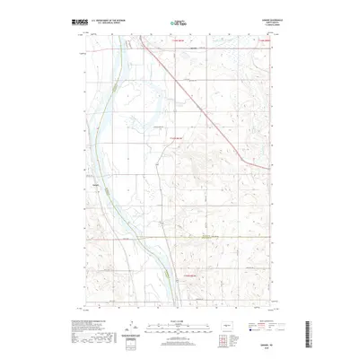
2020 Map of Sanger
USGS Topo · Published 2020About this map
The Missouri River serves as the dominant geographical divide for this territory, marking the borders between Oliver, McLean, and Burleigh Counties. The settlement of Sanger is positioned on the western bank, while the eastern side is defined by the winding paths of Painted Woods Creek and Goose Cr. This 2020 map documents the contemporary rural landscape, where large-scale agricultural sections are interlaced with local routes like Painted Woods Rd and Prairie Trl. Genealogists may find interest in the location of Wing Cem, situated north of the primary road network near the border with Merida. The terrain transitions from the low-lying wetlands of Beaver Lake to the higher elevations cut by Yanktonai Cr, illustrating the drainage patterns that have shaped land use in this part of North Dakota for generations.
Find a feature on this map
37 named features on this map. Tap any name to fly to it.
Don’t see what you’re looking for? This feature index may not catch every label — zoom into the map to look around manually.
Map Details
Editions of this 2020 Sanger Map
This is the sole edition of this map. No revisions or reprints were ever made.
Other maps of this area

1949 · Turtle Creek
USGS Topo · 1:62,500

1949 · Washburn
USGS Topo · 1:62,500

1950 · Wilton
USGS Topo · 1:62,500

1954 · McClusky
USGS Topo · 1:250,000

1958 · McClusky
USGS Topo · 1:250,000

1961 · Turtle Creek SW
USGS Topo · 1:24,000

1961 · Washburn
USGS Topo · 1:24,000

1961 · Turtle Creek SE
USGS Topo · 1:24,000

1966 · Price
USGS Topo · 1:24,000

1966 · Wilton SE
USGS Topo · 1:24,000