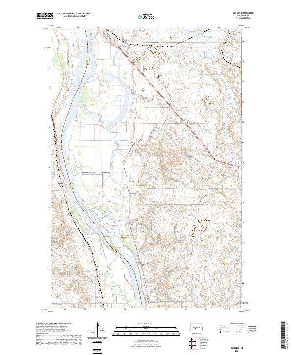
2024 Map of Sanger
USGS Topo · Published 2024About this map
The Missouri River carves a deep path through this North Dakota landscape, marking the tri-county boundary where Oliver, McLean, and Burleigh counties meet. The small settlements of Sanger, Merida, and Wing dot the region, connected by a network of rural roads such as Painted Woods Rd and Co Hwy 24. Significant water features including Painted Woods Creek, Goose Creek, and Beaver Lake drain the undulating terrain toward the main river channel. In the northeast corner, the Lost Lake National Wildlife Refuge provides a protected environment for local flora and fauna. Genealogists and local historians can trace the proximity of a Cemetery near Wing, while the Cross Ranch Trails Trl suggests the continued recreational and natural importance of the river’s western banks.
Find a feature on this map
37 named features on this map. Tap any name to fly to it.
Don’t see what you’re looking for? This feature index may not catch every label — zoom into the map to look around manually.
Map Details
Editions of this 2024 Sanger Map
This is the sole edition of this map. No revisions or reprints were ever made.
Other maps of this area

1949 · Turtle Creek
USGS Topo · 1:62,500

1949 · Washburn
USGS Topo · 1:62,500

1950 · Wilton
USGS Topo · 1:62,500

1954 · McClusky
USGS Topo · 1:250,000

1958 · McClusky
USGS Topo · 1:250,000

1961 · Turtle Creek SW
USGS Topo · 1:24,000

1961 · Washburn
USGS Topo · 1:24,000

1961 · Turtle Creek SE
USGS Topo · 1:24,000

1966 · Price
USGS Topo · 1:24,000

1966 · Wilton SE
USGS Topo · 1:24,000