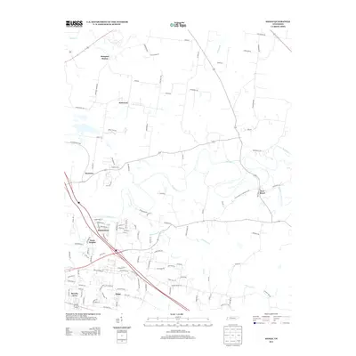
2013 Map of Sango
USGS Topo · Published 2013About this map
The Red River and the Sulphur Fork Red River converge near the historic settlement of Port Royal, where old river-oriented transport routes meet modern road networks. This region east of Clarksville demonstrates a landscape transitioning from traditional farming communities like Hampton Station and Rossview to growing residential developments such as Windermere, Royalty Acres, and Paula Heights. The drainage patterns of Passenger Cr, Spring Cr, and Coon Cr define the rolling topography, while long-established local roads including the Old Clarksville Springfield Rd and Sadlersville Rd trace the paths of early commerce. At the southern edge, the community of Sango serves as a focal point for this evolving rural-suburban interface, preserving the names of local families in its many documented lane and road labels.
Find a feature on this map
112 named features on this map. Tap any name to fly to it.
Don’t see what you’re looking for? This feature index may not catch every label — zoom into the map to look around manually.
Map Details
Editions of this 2013 Sango Map
This is the sole edition of this map. No revisions or reprints were ever made.
Other maps of this area

1944 · Clarksville
USGS Topo · 1:50,000

1950 · Allensville
USGS Topo · 1:24,000

1950 · Guthrie
USGS Topo · 1:24,000

1951 · Hammacksville
USGS Topo · 1:24,000

1951 · Clarksville
USGS Topo · 1:24,000

1956 · Nashville
USGS Topo · 1:250,000

1957 · Adams
USGS Topo · 1:24,000

1957 · Pleasant View
USGS Topo · 1:24,000

1957 · Henrietta
USGS Topo · 1:24,000

1957 · Sango
USGS Topo · 1:24,000
Featured Places
- Clarksville, TN
- Sango, TN
- Paula Heights, Clarksville
- Red River Estates, Clarksville
- Royalty Acres, Clarksville