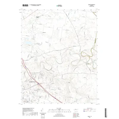
2019 Map of Sango
USGS Topo · Published 2019About this map
Port Royal sits at the significant confluence where the Sulphur Fork Red River joins the main channel of the Red River, a geographic centerpiece of this northeastern Clarksville periphery. The landscape is defined by the winding river valley and the scattered residential clusters of Hampton Station, Kirkwood, and Rossview, reflecting the suburban expansion of Montgomery County in the early 21st century. The map provides a detailed look at the road network connecting these communities, including Rossview Rd and Trough Springs Rd, alongside more modern developments like Boyer Farms. To the south, the community of Sango and the Rest Haven Memorial Gardens mark the transition toward more densely populated areas. Numerous small waterways, such as Passenger Cr and Browns Br, crisscross the undulating terrain, interspersed with open spaces like Blue Ridge Field.
Find a feature on this map
106 named features on this map. Tap any name to fly to it.
Don’t see what you’re looking for? This feature index may not catch every label — zoom into the map to look around manually.
Map Details
Editions of this 2019 Sango Map
This is the sole edition of this map. No revisions or reprints were ever made.
Other maps of this area

1944 · Clarksville
USGS Topo · 1:50,000

1950 · Allensville
USGS Topo · 1:24,000

1950 · Guthrie
USGS Topo · 1:24,000

1951 · Hammacksville
USGS Topo · 1:24,000

1951 · Clarksville
USGS Topo · 1:24,000

1956 · Nashville
USGS Topo · 1:250,000

1957 · Adams
USGS Topo · 1:24,000

1957 · Pleasant View
USGS Topo · 1:24,000

1957 · Henrietta
USGS Topo · 1:24,000

1957 · Sango
USGS Topo · 1:24,000
Featured Places
- Clarksville, TN
- Sango, TN
- Paula Heights, Clarksville
- Red River Estates, Clarksville
- Royalty Acres, Clarksville