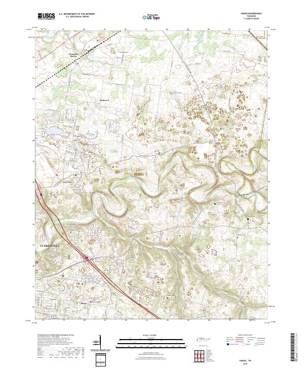
2022 Map of Sango
USGS Topo · Published 2022About this map
Red River and the Sulphur Fork Red River converge in the eastern portion of this quadrangle, shaping a landscape defined by sharp river bends and rising bluffs. The community of Port Royal sits near this confluence, a site of long-standing regional importance where early river-based trade and later road networks met. The terrain here transitions from the flatter agricultural expanses around Hampton Station and Kirkwood in the north toward the more complex drainage systems of Coon Cr and Passenger Cr in the south.
Find a feature on this map
112 named features on this map. Tap any name to fly to it.
Don’t see what you’re looking for? This feature index may not catch every label — zoom into the map to look around manually.
Map Details
Editions of this 2022 Sango Map
This is the sole edition of this map. No revisions or reprints were ever made.
Other maps of this area

1944 · Clarksville
USGS Topo · 1:50,000

1950 · Allensville
USGS Topo · 1:24,000

1950 · Guthrie
USGS Topo · 1:24,000

1951 · Hammacksville
USGS Topo · 1:24,000

1951 · Clarksville
USGS Topo · 1:24,000

1956 · Nashville
USGS Topo · 1:250,000

1957 · Adams
USGS Topo · 1:24,000

1957 · Pleasant View
USGS Topo · 1:24,000

1957 · Henrietta
USGS Topo · 1:24,000

1957 · Sango
USGS Topo · 1:24,000