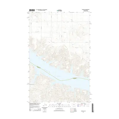
2014 Map of Sanish SE
USGS Topo · Published 2014About this map
Lake Sakakawea dominates this landscape where the Missouri River has been transformed into a massive reservoir, marking the border between Mountrail and Dunn counties. The intricate shoreline is defined by numerous inlets and bays, including Drags Wolf Bay, which reflect the inundated topography of the Missouri breaks. To the north, a system of section-line roads such as 31st St NW and 30th St NW overlays the high plains, while drainage features like Little Shell Cr and Horse Camp Coulee carve through the breaks toward the water's edge. This map documents the modern contours of the Missouri River valley, showing how the river's original path is now subsumed within the broader expanse of the lake.
Find a feature on this map
11 named features on this map. Tap any name to fly to it.
Don’t see what you’re looking for? This feature index may not catch every label — zoom into the map to look around manually.
Map Details
Editions of this 2014 Sanish SE Map
This is the sole edition of this map. No revisions or reprints were ever made.
Other maps of this area

1953 · Watford City
USGS Topo · 1:250,000

1957 · Watford City
USGS Topo · 1:250,000

1967 · Watford City
USGS Topo · 1:250,000

1967 · Sanish NW
USGS Topo · 1:24,000

1967 · Sanish
USGS Topo · 1:24,000

1967 · Sanish SE
USGS Topo · 1:24,000

1967 · New Town SW
USGS Topo · 1:24,000

1967 · Sanish SW
USGS Topo · 1:24,000

1970 · Mandaree
USGS Topo · 1:24,000

1970 · String Buttes
USGS Topo · 1:24,000