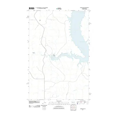
2011 Map of Sanish SW
USGS Topo · Published 2011About this map
Lake Sakakawea and the Missouri River dominate this portion of the North Dakota landscape, revealing the complex water systems shaped by the Garrison Dam project. The topographic detail highlights the transition from the river's main channel to the branching inlets of Writing Rock Coulee and Bear Den Creek. Elevated landmarks like Blue Butte provide significant topographical relief against the surrounding plains, serving as traditional navigational points for the region's inhabitants.
Find a feature on this map
9 named features on this map. Tap any name to fly to it.
Don’t see what you’re looking for? This feature index may not catch every label — zoom into the map to look around manually.
Map Details
Editions of this 2011 Sanish SW Map
This is the sole edition of this map. No revisions or reprints were ever made.
Other maps of this area

1953 · Watford City
USGS Topo · 1:250,000

1957 · Watford City
USGS Topo · 1:250,000

1965 · Blue Buttes
USGS Topo · 1:24,000

1965 · Blue Buttes SE
USGS Topo · 1:24,000

1967 · Watford City
USGS Topo · 1:250,000

1967 · Sanish NW
USGS Topo · 1:24,000

1967 · Sanish
USGS Topo · 1:24,000

1967 · Sanish SE
USGS Topo · 1:24,000

1967 · Sanish SW
USGS Topo · 1:24,000

1970 · Mandaree
USGS Topo · 1:24,000