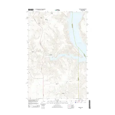
2014 Map of Sanish SW
USGS Topo · Published 2014About this map
Mandaree serves as the primary settlement in this Western North Dakota landscape, situated at the junction of Highway 22 N and Bia-12. The geography is defined by the deep indentations of Lake Sakakawea, most notably at Bear Den Bay, where the Missouri River forms the border between McKenzie and Mountrail counties. The surrounding terrain is a complex network of erosional features, including Rough Coulee, Whitebody Coulee, and Horse Camp Coulee. These drainage patterns illustrate the rugged breaks leading down to the river valley. Landmarks like Blue Butte provide vertical relief in an area where local infrastructure, such as 25th St NW and 31st St NW, navigates the winding draws of Writing Rock Coulee and Foreman Coulee.
Find a feature on this map
20 named features on this map. Tap any name to fly to it.
Don’t see what you’re looking for? This feature index may not catch every label — zoom into the map to look around manually.
Map Details
Editions of this 2014 Sanish SW Map
This is the sole edition of this map. No revisions or reprints were ever made.
Other maps of this area

1953 · Watford City
USGS Topo · 1:250,000

1957 · Watford City
USGS Topo · 1:250,000

1965 · Blue Buttes
USGS Topo · 1:24,000

1965 · Blue Buttes SE
USGS Topo · 1:24,000

1967 · Watford City
USGS Topo · 1:250,000

1967 · Sanish NW
USGS Topo · 1:24,000

1967 · Sanish
USGS Topo · 1:24,000

1967 · Sanish SE
USGS Topo · 1:24,000

1967 · Sanish SW
USGS Topo · 1:24,000

1970 · Mandaree
USGS Topo · 1:24,000