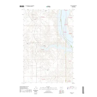
2020 Map of Sanish SW
USGS Topo · Published 2020About this map
Lake Sakakawea and the ancient course of the Missouri River dominate this landscape, where the waters meet the complex breaks of the Missouri Plateau. This modern survey illustrates the rugged drainage systems that feed the reservoir, including the deep incisions of Whitebody Coulée and Horse Camp Coulee. High points like Blue Butte provide significant topographic relief above the surrounding plains, marking the divide between the river valley and the interior uplands.
Find a feature on this map
23 named features on this map. Tap any name to fly to it.
Don’t see what you’re looking for? This feature index may not catch every label — zoom into the map to look around manually.
Map Details
Editions of this 2020 Sanish SW Map
This is the sole edition of this map. No revisions or reprints were ever made.
Other maps of this area

1953 · Watford City
USGS Topo · 1:250,000

1957 · Watford City
USGS Topo · 1:250,000

1965 · Blue Buttes
USGS Topo · 1:24,000

1965 · Blue Buttes SE
USGS Topo · 1:24,000

1967 · Watford City
USGS Topo · 1:250,000

1967 · Sanish NW
USGS Topo · 1:24,000

1967 · Sanish
USGS Topo · 1:24,000

1967 · Sanish SE
USGS Topo · 1:24,000

1967 · Sanish SW
USGS Topo · 1:24,000

1970 · Mandaree
USGS Topo · 1:24,000