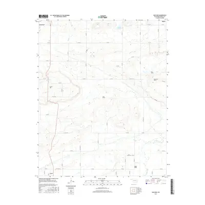
2016 Map of Sans Bois
USGS Topo · Published 2016About this map
Sans Bois and the surrounding drainage of Sans Bois Creek define this section of Haskell County, where the landscape transitions between the elevated heights of Beaver Mtn and several distinct lowlands. The terrain is marked by a series of named valleys including Lona Valley, Pruit Valley, and Shropshire Valley, which dictate the rural road network. Smaller watercourses like Fish Cr, Snake Cr, and Kings Cr thread through the township sections, supporting a few localized water bodies such as Fenton Lake.
Find a feature on this map
48 named features on this map. Tap any name to fly to it.
Don’t see what you’re looking for? This feature index may not catch every label — zoom into the map to look around manually.
Map Details
Editions of this 2016 Sans Bois Map
This is the sole edition of this map. No revisions or reprints were ever made.
Other maps of this area

1900 · Sansbois
USGS Topo · 1:125,000

1909 · Sans Bois
USGS Topo · 1:125,000

1911 · Sansbois
USGS Topo · 1:125,000

1946 · Fort Smith
USGS Topo · 1:250,000

1962 · Stigler East
USGS Topo · 1:24,000

1962 · Stigler West
USGS Topo · 1:24,000

1963 · Porum
USGS Topo · 1:24,000

1965 · Fort Smith
USGS Topo · 1:250,000

1967 · Fort Smith
USGS Topo · 1:250,000
1968 · Lafayette
USGS Topo · 1:24,000