
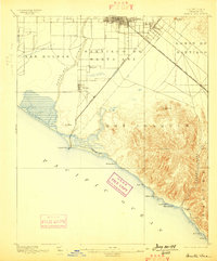
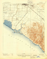
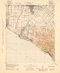
1947 Map of Santa Ana
USGS Topo · Published 1949About this map
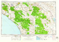
Santa Ana and the coastal plains of Southern California are shown here just after the war, a landscape where expanding orange groves meet an increasing military presence. Strategic installations like March Field and Camp Haan Mil Res sit near the growing city centers of Riverside and Fullerton. This era marks the transition of the region from a purely agricultural powerhouse to an industrial and residential hub, connected by the Atchison Topeka and Santa Fe RR and Southern Pacific RR.
Find a feature on this map
169 named features on this map. Tap any name to fly to it.
Don’t see what you’re looking for? This feature index may not catch every label — zoom into the map to look around manually.
Map Details
Editions of this 1947 Santa Ana Map
This is the sole edition of this map. No revisions or reprints were ever made.
Historical Maps of San Diego Through Time
10 maps found
1896 Santa Ana
Orange County, CA
1901 Santa Ana
Orange County, CA
1942 Santa Ana
Orange County, CA
1947 Santa Ana
Orange County, CA

1949 Santa Ana
Orange County, CA

1956 Santa Ana
Orange County, CA
1959 Santa Ana
Orange County, CA
1960 Santa Ana
Orange County, CA

1965 Santa Ana
Orange County, CA

1983 Santa Ana
Orange County, CA