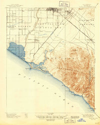
1901 Map of Santa Ana
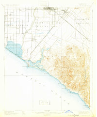
USGS Topo · Published 1945About this map
Santa Ana and the surrounding coastal plains appear here at a pivotal moment when the landscape was defined by vast land grants like Las Bolsas and Santiago De Santa Ana. The settlement pattern reflects the agricultural and transit priorities of the era, with small towns such as Talbert, Wintersburg, and Smeltzer dotting the lowlands near the Santa Ana River. The infrastructure of the early 20th century is clearly visible through the rail networks, including the Southern California Railroad (Surf Line) and the Newport Branch, which connected inland citrus and farming centers to the coast.
Find a feature on this map
41 named features on this map. Tap any name to fly to it.
Don’t see what you’re looking for? This feature index may not catch every label — zoom into the map to look around manually.
Map Details
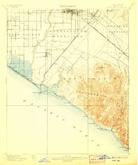
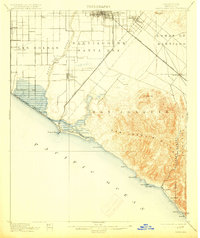
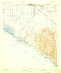
Editions of this 1901 Santa Ana Map
6 editions found
Other maps of this area

1896 · Santa Ana
USGS Topo · 1:62,500

1896 · Anaheim
USGS Topo · 1:62,500

1896 · Las Bolsas
USGS Topo · 1:62,500

1896 · Downey
USGS Topo · 1:62,500

1898 · Anaheim
USGS Topo · 1:62,500

1899 · Downey
USGS Topo · 1:62,500

1901 · Southern California Sheet No. 1
USGS Topo · 1:250,000

1901 · Santa Ana
USGS Topo · 1:62,500

1901 · Anaheim
USGS Topo · 1:62,500

1902 · Capistrano
USGS Topo · 1:125,000