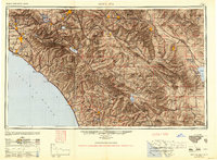
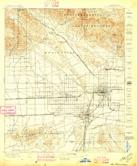
1949 Map of Santa Ana
USGS Topo · Published 1949About this map
Camp Pendleton and March Field anchor a landscape transitioning from agricultural heartlands to mid-century strategic hubs. This survey illustrates the dense orange groves and established town centers of Santa Ana, Anaheim, and Fullerton before the post-war suburban boom fully reshaped the region. Coastal settlements such as Oceanside, Laguna Beach, and Carlsbad appear alongside the intricate wetlands of Agua Hedionda Lagoon and Batiquitos Lagoon, while the interior reveals the vast, undeveloped expanses of the Cleveland National Forest and Anza-Borrego State Park.
Find a feature on this map
102 named features on this map. Tap any name to fly to it.
Don’t see what you’re looking for? This feature index may not catch every label — zoom into the map to look around manually.
Map Details
Editions of this 1949 Santa Ana Map
This is the sole edition of this map. No revisions or reprints were ever made.
Other maps of this area
1893 · El Cajon
USGS Topo · 1:62,500
1893 · Oceanside
USGS Topo · 1:62,500
1893 · Escondido
USGS Topo · 1:62,500

1894 · Los Angeles
USGS Topo · 1:62,500

1894 · Pomona
USGS Topo · 1:62,500

1896 · Santa Ana
USGS Topo · 1:62,500

1896 · Pasadena
USGS Topo · 1:62,500

1896 · Anaheim
USGS Topo · 1:62,500
1896 · San Bernardino
USGS Topo · 1:62,500

1896 · Las Bolsas
USGS Topo · 1:62,500