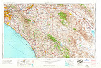
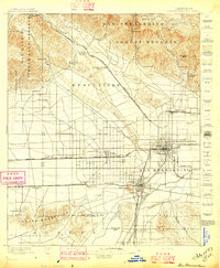
1965 Map of Santa Ana
USGS Topo · Published 1965About this map
Santa Ana and the burgeoning suburbs of Orange County stand at a pivotal moment of mid-century expansion on this regional study. From Anaheim to Huntington Beach, the grid of the Santa Ana Freeway and San Diego Freeway begins to define the modern metropolitan landscape, while older transit corridors like the Atchison Topeka and Santa Fe RR continue to serve established industrial hubs. To the east, the map captures the transition from urban centers to the high desert, reaching the western edge of the Salton Sea.
Find a feature on this map
93 named features on this map. Tap any name to fly to it.
Don’t see what you’re looking for? This feature index may not catch every label — zoom into the map to look around manually.
Map Details
Editions of this 1965 Santa Ana Map
This is the sole edition of this map. No revisions or reprints were ever made.
Other maps of this area
1893 · El Cajon
USGS Topo · 1:62,500
1893 · Oceanside
USGS Topo · 1:62,500
1893 · Escondido
USGS Topo · 1:62,500

1894 · Los Angeles
USGS Topo · 1:62,500

1894 · Pomona
USGS Topo · 1:62,500

1896 · Santa Ana
USGS Topo · 1:62,500

1896 · Pasadena
USGS Topo · 1:62,500

1896 · Anaheim
USGS Topo · 1:62,500
1896 · San Bernardino
USGS Topo · 1:62,500

1896 · Las Bolsas
USGS Topo · 1:62,500