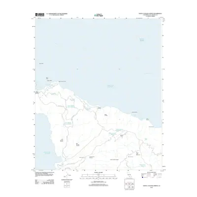
2012 Map of Santa Catalina North
USGS Topo · Published 2012About this map
Two Harbors serves as the focal point for this section of Santa Catalina Island, where the narrow isthmus separates Isthmus Cove from the western waters. This 2012 survey illustrates the island's inland infrastructure, featuring a network of mountain roads such as Empire Landing Rd and Stage Rd that connect remote locales like Wrigley Ranch and Black Jack Camp.
Find a feature on this map
46 named features on this map. Tap any name to fly to it.
Don’t see what you’re looking for? This feature index may not catch every label — zoom into the map to look around manually.
Map Details
Editions of this 2012 Santa Catalina North Map
This is the sole edition of this map. No revisions or reprints were ever made.
Other maps of this area

1896 · San Pedro
USGS Topo · 1:62,500

1901 · Southern California Sheet No. 1
USGS Topo · 1:250,000

1904 · Southern California Sheet No. 1
USGS Topo · 1:250,000

1943 · San Pedro
USGS Topo · 1:125,000

1943 · Santa Catalina North
USGS Topo · 1:24,000

1943 · Santa Catalina East
USGS Topo · 1:24,000

1943 · Santa Catalina South
USGS Topo · 1:24,000
1943 · Santa Catalina West
USGS Topo · 1:24,000
1944 · San Pedro
USGS Topo · 1:62,500

1949 · Long Beach
USGS Topo · 1:250,000