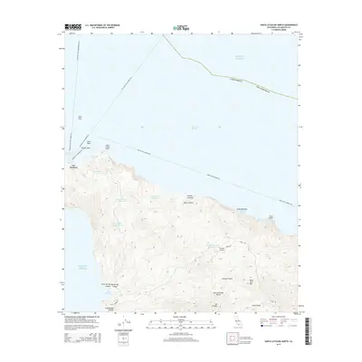
2015 Map of Santa Catalina North
USGS Topo · Published 2015About this map
Two Harbors serves as the central hub on this portion of Santa Catalina Island, where the narrow isthmus separates Fishermans Cove on the north shore from the Pacific Ocean to the south. The landscape is defined by its steep interior topography, rising from coastal points like Blue Cavern Point and Little Gibraltar toward high peaks such as Mt Orizaba and Black Jack Mtn.
Find a feature on this map
37 named features on this map. Tap any name to fly to it.
Don’t see what you’re looking for? This feature index may not catch every label — zoom into the map to look around manually.
Map Details
Editions of this 2015 Santa Catalina North Map
This is the sole edition of this map. No revisions or reprints were ever made.
Other maps of this area

1896 · San Pedro
USGS Topo · 1:62,500

1901 · Southern California Sheet No. 1
USGS Topo · 1:250,000

1904 · Southern California Sheet No. 1
USGS Topo · 1:250,000

1943 · San Pedro
USGS Topo · 1:125,000

1943 · Santa Catalina North
USGS Topo · 1:24,000

1943 · Santa Catalina East
USGS Topo · 1:24,000

1943 · Santa Catalina South
USGS Topo · 1:24,000
1943 · Santa Catalina West
USGS Topo · 1:24,000
1944 · San Pedro
USGS Topo · 1:62,500

1949 · Long Beach
USGS Topo · 1:250,000