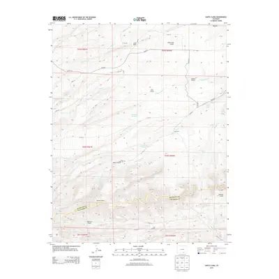
2013 Map of Santa Clara
USGS Topo · Published 2013About this map
Thomas Rodger Cem sits on a high bench overlooking Boiler Canyon, a site of significant interest for genealogists tracing early families in this part of southern Colorado. The landscape is defined by the transition from high plains to the rising foothills, marked by distinctive geological features like Big Dike and Small Dyke. Ranching infrastructure is prominent across the terrain, evidenced by the Santa Clara Windmill and water management sites including the Arnold Flood Water Reservoir and Sunnyside Reservoir. The drainage network, centered on N Santa Clara Cr and S Santa Clara Cr, reveals the critical role of water in this semi-arid environment. Named springs such as Boiler Spring and Lower Duhme Spring further highlight the localized water sources that supported the small Santa Clara settlement and surrounding operations along the Huerfano and Las Animas county line.
Find a feature on this map
46 named features on this map. Tap any name to fly to it.
Don’t see what you’re looking for? This feature index may not catch every label — zoom into the map to look around manually.
Map Details
Editions of this 2013 Santa Clara Map
This is the sole edition of this map. No revisions or reprints were ever made.
Other maps of this area

1891 · Walsenburg
USGS Topo · 1:125,000

1891 · Spanish Peaks
USGS Topo · 1:125,000

1893 · Spanish Peaks
USGS Topo · 1:125,000

1894 · Walsenburg
USGS Topo · 1:125,000

1895 · Spanish Peaks
USGS Topo · 1:125,000

1897 · Walsenburg
USGS Topo · 1:125,000

1897 · Spanish Peaks
USGS Topo · 1:125,000

1900 · Spanish Peaks
USGS Topo · 1:125,000

1900 · Walsenburg
USGS Topo · 1:125,000

1954 · Trinidad
USGS Topo · 1:250,000