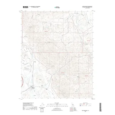
2018 Map of Santa Margarita
USGS Topo · Published 2018About this map
The town of Santa Margarita serves as the focal point for this survey of the Central Coast interior, situated where the Salinas River meets the rugged transitions of Granite Ridge. The landscape is defined by its drainage systems, including the complex headwaters of the East Branch Huerhuero Creek and Middle Br Huerhuero Cr. A significant modern engineering feature, the Governor Edmund G Brown Coastal Br California Aqueduct, cuts across the terrain near the Santa Margarita Cem, illustrating the massive infrastructure required to move water through this region.
Find a feature on this map
69 named features on this map. Tap any name to fly to it.
Don’t see what you’re looking for? This feature index may not catch every label — zoom into the map to look around manually.
Map Details
Editions of this 2018 Santa Margarita Map
This is the sole edition of this map. No revisions or reprints were ever made.
Other maps of this area

1897 · San Luis Obispo
USGS Topo · 1:62,500

1900 · San Luis
USGS Topo · 1:125,000

1914 · Cholame
USGS Topo · 1:125,000

1915 · Cholame
USGS Topo · 1:125,000

1917 · Cholame
USGS Topo · 1:125,000

1919 · Paso Robles
USGS Topo · 1:62,500

1922 · Pozo
USGS Topo · 1:62,500

1942 · San Luis Obispo
USGS Topo · 1:62,500

1943 · Paso Robles
USGS Topo · 1:62,500

1943 · Shedd Canyon
USGS Topo · 1:31,680